Dear friends,
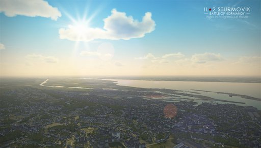
Today we can show you a teaser, the first screenshot of the Normandy map showing one of its characteristic features - a coastal port city. Le Havre, in the Seine estuary, is one of the biggest in France. Our map development team always tries to find new ways to improve the landscape elements, and now, working on the Normandy map, they are researching new techniques of terrain texturing, coastline composition, keeping in mind the differences in the architecture and city layout between the two sides of the Channel, attempting to recreate more detailed railway junctions and many other things.

Speaking of the railway junctions, some of you have pointed out that they are too simplified on the Rheinland map. They were made simple because the development was focused on many detailed airfields, but we're always trying to improve the existing content and other things whenever we have time and resources to do so. This year we plan to gradually add more detailed railway junctions to this map. This is the Antwerp railyard being improved:
